Holkham Park

Combined Shape Created with Sketch.

As with so much of the English countryside the look of the Norfolk coast is an intimate blend, part wilderness and part working landscape. From Burnham Overy to Wells the low-lying grazing marshes north of the coast road used to be tidal saltmarshes, separating offshore shingle and dune ridges from the main coastline.

Holkham Park

The tidal creeks were large enough to allow ships to load cargo from a staithe at Holkham village. From 1639 onwards a series of embankments were constructed by local landowners, including the Cokes of Holkham. By the time the Wells embankment was completed in 1859 by the 2nd Earl of Leicester about 800 hectares of saltmarsh had been converted to agricultural use.

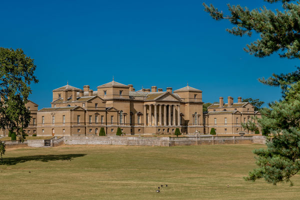
In the late 19th century the 3rd Earl of Leicester planted pine trees on the dunes, creating a shelter-belt to protect the reclaimed farmland from wind-blown sand. Today the ribbon of mature woodland still separates seascape from farmscape. The fields and dykes, ridges and trackways have become part of the landscape. Nature moves on; Thomas Coke, the great agricultural pioneer whose memorial can be seen above the treeline in nearby Holkham Park, would hardly recognise the place.

July 2017 - Holkham Estate, has been awarded Approved Body Status under Section 35 of the Wildlife and Countryside Act. This will make Holkham one of a select few privately owned estates in England to hold this status and follows a lengthy application process. This special status will enable the estate to manage the Holkham National Nature Reserve, which has until now been managed by Natural England.

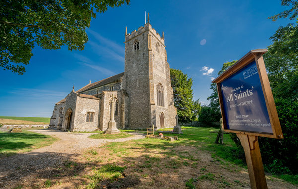
Guided walks throughout the year are an ideal way to discover the diversity of wildlife on the Nature Reserve. Visit the Holkham Estate website (www.holkham.co.uk) for more information.

A few facts about Holkham:

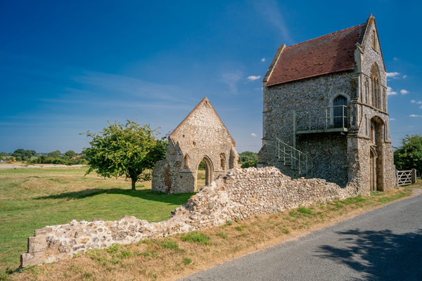
Holkham Fort, near Bone’s Drove, dates back to around AD47 and is the remains of an Iceni settlement. Warriors of this tribe fought with Queen Boudica (Boadicea) against the Romans.

Holkham is the home of Coke of Norfolk, whose Holkham Shearings (gatherings of farmers and friends to discuss agricultural matters) helped to encourage agricultural reform. A memorial to Coke of Norfolk can be seen in Holkham Park to the south of the reserve.

Saltmarsh reclamation began on this coast at Burnham Overy in 1639 and was completed in 1859 with the construction of the Wells sea wall.

The Vikings sailed up a creek through the saltmarshes during the first millennium and built a fort at a bleak place they called Holkham (‘ship town’ in Danish).

As recently as 1986 Wells Harbour handled up to 200 large vessels and 100,000 tons of cargo (mostly animal feeds) annually. Nowadays a few crab boats and pleasure craft are all that remain.

Lord Nelson spent many of his boyhood days exploring this stretch of coast.

Site Information
Opening Times:
Daylight hours
Website:
Address:
Holkham Hall, Wells-next-the-Sea, NR23 1AB, Norfolk
Visitor Information
Parking
Yes
Refreshments (nearby)
Yes
Dog friendly
Yes
Features
Atmosphere
Wildlife
Nearby Attractions
Attraction 1:
Holkham Hall
route-icon
0.87 Miles Away
With a stunning location on the Norfolk coast and at the heart of a thriving 25,000 acre estate, Holkham Hall is described as an exceptional place, rich in history, architecture and wildlife. The seat of the Earls of Leicester, this elegant 18th century mansion is still very much a lived-in family home which the family take pride in sharing with visitors.
View Venue
Attraction 2:
Church of All Saints, Burnham Thorpe
route-icon
2.83 Miles Away
Late Victorian restored from original C14 building in which Horatio Nelson's parents (his father was the rector) are buried. Nelson was baptised in its medieval font. Many naval references, including: altar, lectern and rood made from HMS Victory; battle ensigns from HMS Nelson and Indomitable the latter flown at the Battle of Jutland; bust of Nelson in the chancel.
View Venue
Attraction 3:
Carmelite Friary of St Mary, Burnham Norton (Ruins)
route-icon
3.4 Miles Away
This Friary was founded in 1241 by Sir William de Caithorpe of Burnham Thorpe and Sir Roger de Hemenshale, Lord of Polstead Manor in Burnham. It is thought to be the first Carmelite Friary established in Norfolk. Its gatehouse can still be seen, with its fine 14th century decoration, to the east of the church, between the modern school building and Overy Church. The Friary occupied the land between the gatehouse and the River Burn.
View Venue
Attraction 4:
Church of St Margaret, Burnham Norton
route-icon
3.59 Miles Away
The Saxon round tower was built at the beginning of the first millennium, the church was extended in the 13th century, with later improvements in the 15th. It has a commanding view of the sea half a mile away. St Margaret's stands within its own burial ground; on the other side of the north bank of this is the burial area for the rest of Burnham Market.
View Venue
Attraction 5:
The Church of St Mary the Virgin, North Creake
route-icon
4.57 Miles Away
St Mary's church is a large medieval building. The church dates to the 14th century, a time when Norfolk 's economy was booming thanks to the wool trade, and the wealthy merchants poured money into their local parish churches.
View Venue
Group 3Created with Sketch. new arrowCreated with Sketch. Group 2Created with Sketch. new arrowCreated with Sketch. safetyCreated with Sketch. Group 7Created with Sketch. Combined ShapeCreated with Sketch.blue arrowCreated with Sketch. finishCreated with Sketch. F map pinCreated with Sketch. NO IMAGE AVAILABLE startCreated with Sketch. S