In the many years of excavation that have followed to date, the Campbell family has remained interested and supportive and has become the ever-willing patron of one of the largest and longest-running archaeological research and training projects in Britain.
SHARP was set up without specific project designs - and continues to operate that way today - but has a broad objective of understanding human settlement and land usage within the parish. We have undertaken a wide range of excavation and research projects from an Early Bronze Age crouch-burial through to a First World War aerodrome.
In addition to our research, SHARP has always placed great emphasis on archaeological education and development. Since the project was formed back in 1996, thousands of people have arrived at our Boneyard Field site to excavate, carry out research, or take one of our many courses. Many archaeologists got their start at SHARP. Large numbers of these people now work today in a variety of roles in commercial archaeology, academic research and the heritage sector.
Research: Late Mesolithic
Our knowledge of human settlement within Sedgeford during the prehistoric period remains scant, with no known evidence for settlement occurring prior to the Late Iron Age. However, close to 600 pieces of worked flint have been recovered from the Boneyard/Reeddam site, although none were recovered from sealed contexts. Some of the most distinctive pieces found from the site are microliths dating from the Late Mesolithic period. The Boneyard/Reeddam site is located towards the bottom of the Heacham River valley, which would have been a much more substantial feature in the landscape during this period, when it may have been the site of a temporary hunting camp.
Late Neolithic, early Bronze Age
The archaeological footprint from this period at Sedgeford is also minimal. A number of ploughed-out round barrows are located to both the north and south of the Heacham River within the parish. A small assemblage of worked flint artefacts from the Late Neolithic period have also been recovered, again mostly from unsealed contexts.
In 2009, while excavating the Middle Anglo-Saxon settlement site, a crouched burial was discovered, containing the skeleton of a young adult. Subsequent radiocarbon dating dated the skeleton to 2458-2200 cal. BC. It was not possible to determine the sex or height of the skeleton but the person would have been around 20 years old at the time of death. Research has shown that the person had suffered delayed skeletal development, possibly caused by periods of severe malnutrition or bouts of extended illness. Two objects were found within the grave fill; a large flat-topped flint with rounded corners and a part of a worked red deer antler.
Iron Age
SHARP have not been able to date any Iron Age settlement activity at Sedgeford before the Late Iron Age. In 2010, a second crouched burial was discovered close to the previous year’s Late Neolithic/Early Bronze Age burial. The grave contained the skeleton of an approximately 50 year old female. Also found within the grave fill was a cow scapula and another flat-topped flint nodule, along with six bead-like objects, one being a man-made amber bead, another bead of baked clay and the rest being fossils. Nine sherds of pottery were also found within the grave fill; an intrusive Anglo-Saxon sherd from an upper fill, the rest being Iron Age from lower fills. Radiocarbon dating gave a date of death of 373 – 203 cal. BC, making this solitary Middle Iron Age burial an unusual one for the region.
Romano British.
Within the 2006 trench in Chalkpit Field, features relating to the successor site to the abandoned Iron Age site were uncovered. After a hiatus of around 50 years, a Romano-British farmstead is established within the area in a slightly different location and with a radically new layout. Pottery assemblages from the site’s deposits suggest a long period of activity from the late 1st century through to at least the mid-3rd century.
Anglo-Saxon
The Early Anglo-Saxon period at Sedgeford is not well represented, with settlement evidence remaining elusive. During the 19th and early 20th century, three cremation urns were found within the parish but the evidence for where the urns were found is contradictory at best. The first urn is of decorated design and was found in 1826 during work in a gravel quarry ‘north of the river’. The second is a plain cremation urn, also found during the 19th century. Both urns are held at Norwich Castle Museum. The third urn is again of plain design but with three bands around the shoulder. More than 180 artefacts have been found by metal detector to the west of Sedgeford, adjacent to a known Early Anglo-Saxon inhumation cemetery. Both this cemetery and the probable locations of the cremation urns are some distance away from the Middle Anglo-Saxon site.
Medieval
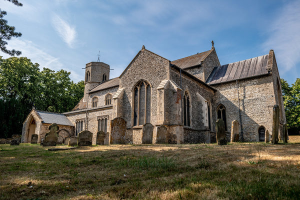
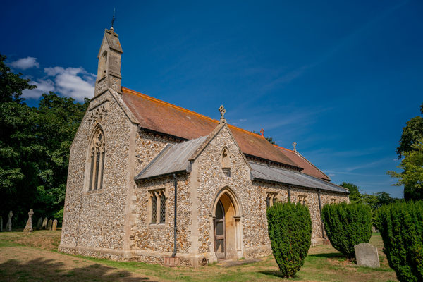
At a point in the latter half of the 11th century, the focus of the settlement at Sedgeford shifts north, moving across the river to form the basis of today’s village. The reasons for this are uncertain. What we know is that the settlement moved to a point around the contemporary West Hall, south of the Early Medieval parish church. Excavations carried out between 1996 – 2000 in the adjacent West Hall Paddock uncovered the remains of foundations to a structure. Three nearby, west-east aligned, grave cuts imply the building may have been religious in nature. Radiocarbon dating from one of the burials produced an age of between AD 1010 -1180. The earliest documentary evidence for a church in Sedgeford dates from 1205 but none of the surviving fabric of the current building dates to before the 13th century. The church grew considerably throughout the Medieval period while Sedgeford enjoyed strong links with Norwich Cathedral Priory. The modern-day church of St. Mary the Virgin lies very close to this West Hall Paddock site.
First World War
In 2009 research began on the site of a WWI aerodrome, located to the east of Sedgeford near the border of Docking parish. The aerodrome began life in the spring of 1915 as a night landing ground for the Royal Naval Air Service (RNAS): this was a modest operation with only one aircraft on site and primarily acting as a satellite base for the RNAS Great Yarmouth, South Denes.
During 1916 the site took on a much more substantial role when it became a training station for the fledgling Royal Flying Corps. Tasked with producing pilots for front line combat, a range of buildings and structures were quickly established on the site. The buildings largely fell into three categories - technical, domestic and regimental - and were constructed using either timber-framing or ceramic brick.
Assisted by original documentary archives and aerial photographs of the site, since 2009 SHARP has undertaken one of the most comprehensive archaeological surveys of a British First World War airfield. Some of the aerodrome’s original buildings are still standing, others have been stripped down to their foundations, while others have been lost to almost 100 years of agricultural activity. However, nearly all of these buildings and structures have been surveyed and plotted on to the site. From this we have been able to phase the development of the site from its modest roots as a night landing ground, to a two and then three-squadron training station during the First World war, a day and night-time decoy airfield during World War Two and then back to post-war agricultural use, with some residential dwellings also located on the site.