Gooderstone Water Gardens

Combined Shape Created with Sketch.
Gooderstone Water Gardens

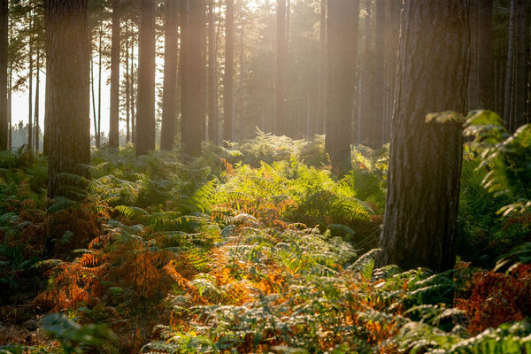
Water gardens covering 6.5 acres, with trout stream, four ponds, waterways, mature trees, colourful plants, kingfisher hide, nature trails and 13 bridges. Tearoom with homemade cakes and disabled toilets.

A unique attraction for all garden lovers, naturalists and photographers - or those who simply want a restful break. Billy Knights, a retired farmer with no training but great enthusiasm began his garden in 1970 according to his own taste; his likes and dislikes were not dictated by fashion. When he died aged 93 in 1994, he left behind an entrancing 6.5 acre garden that sits well in the Norfolk countryside.

From the natural trout stream he created ponds and flowing waterways spanned by thirteen bridges. Combining the native and cultivated plants in informal beds his daughter Coral is endeavouring to further enhance this atmospheric garden. There are mature trees and shrubs, colourful bogs, plants and border perennials and flat grassy paths that lead visitors around corners to more lovely and unexpected views.

There is an 8 acre wildlife area to explore, which is managed to encourage the native flora, and a large bird hide where daily sightings of kingfishers are seen. A bright and cheerful tearoom serves delicious homemade cakes. There are plant sales, toilets for disabled people, dogs on leads are allowed and visitors may picnic anywhere in the garden. This is a truly relaxing place for everyone to be, a real pleasure garden.

Some visitors have written 'this is how I imagine heaven to be!"

What could be nicer than to stroll through an enchanting garden, explore the nature trail, perhaps spot a kingfisher and enjoy tea and yummy homemade cakes.
Site Information
Opening Times:
Monday - Sunday, 10:30am - 5:30pm.
Website:
Address:
The Street, Gooderstone, King's Lynn, PE33 9BP, Norfolk
Nearby Trails
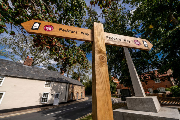
Peddars Way
Explore beyond West Norfolk
route-icon
6.43 Miles Away
The Peddars Way is a long distance footpath in Norfolk, England. It is 46 miles long and follows the route of a Roman road. It has been suggested by more than one writer that it was not created by the Romans but was an ancient trackway, a branch or extension of the Icknield Way, used and remodelled by the Romans. The name is said to be derived from the Latin pedester – on foot. It is first mentioned on a map of 1587 AD. It starts at Knettishall Heath in Suffolk (near the Norfolk-Suffolk border, about 7 km or 4 mi east of Thetford), and links with the Norfolk Coast Path at Holme-next-the-Sea.
View Trail
Nar Valley Way, Setchey and Shouldham Warren walk
route-icon
7.16 Miles Away
A diverse walk through the countryside of the Fens and Brecks, visiting Setchey, Pentney Abbey, Shoudlham Warren and Wormegay along the way
View Trail
Shouldham Warren walk
route-icon
7.23 Miles Away
Shouldham Warren is a fascinating environment where the Brecks merges with the Fens. Beyond the tall pine forest lies the open expanse of the Fens and the valley of the River Nar demonstrating the abrupt change from one natural area to another.
View Trail
Nar Valley Way & Peddars Way, Castle Acre walk
Explore beyond West Norfolk
route-icon
7.41 Miles Away
Pass through South Acre, West Acre and Castle Acre Common. Visiting on the way Remains of the Castle Acre Castle, Bailey Gate and Castle Acre Priory.
View Trail
Nar Valley Way, West Acre walk
Explore beyond West Norfolk
route-icon
7.43 Miles Away
The small village of West Acre is quiet and pretty with some fascinating sites such as the Augustinian Priory. The fords make picturesque features of the peaceful country lanes.
View Trail
Group 3Created with Sketch. new arrowCreated with Sketch. Group 2Created with Sketch. new arrowCreated with Sketch. safetyCreated with Sketch. Group 7Created with Sketch. Combined ShapeCreated with Sketch.blue arrowCreated with Sketch. finishCreated with Sketch. F map pinCreated with Sketch. NO IMAGE AVAILABLE startCreated with Sketch. S